News
adv left
Adjusting the general planning of Ho Chi Minh City: Towards a global city
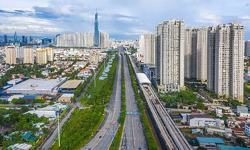 |
| The central goal is to turn Ho Chi Minh City into a highly competitive global city, develop synchronous and harmonious urban space and preserve traditional values - Photo: VGP |
It is necessary to adjust the planning
After more than 10 years of implementing the general planning project, Ho Chi Minh City has made remarkable progress in many aspects. However, the City's general planning has also revealed many inadequacies compared to reality.
For example, inadequacies in the ability to realize land use planning, including public land funds or the ability to compensate for land clearance to build parks, schools, public spaces, etc.
On the other hand, the urban development context when the general plan was formed in 2010 compared to today has had many changes. At that time, Ho Chi Minh City developed urban areas according to a multi-polar centralized model with limited regional infrastructure investment resources, not yet able to promote the strengths of regional development, and not yet create opportunities to develop projects. Breakthrough project in the periphery of the City. Therefore, inner city districts focus on urban development, while suburban districts such as Cu Chi, Nha Be, Binh Chanh, Can Gio are still green areas and have not had development investment based on the strengths of the city. locality in the relationship with regional development.
Reality shows that, in addition to the potential for new development land funds, there is a need to effectively exploit existing land funds, however, technical infrastructure, transportation, drainage systems, schools... have not received equivalent investment. worthy.
Adjusting the general planning of Ho Chi Minh City is an urgent issue for the City to develop and overcome shortcomings. People are looking forward to this planning project with issues such as: Traffic congestion; flood treatment; environmental problems; lack of green areas; housing shortage... Many people are also interested in what the City will do to put the planning content into practice, minimizing the situation of "hanging" planning or installing group interests after each planning adjustment. .
Multi-center urban area
The project to adjust the general planning of Ho Chi Minh City to 2040, with a vision to 2060 (Planning project) has been consulting with experts, managers and residents of the City. This planning project has received great attention from all walks of life and people because it will make an important contribution to the transformation and development process of Ho Chi Minh City until 2040, with a vision to 2060.
Recognizing the importance of this planning project, City leaders have directed the Department of Planning and Architecture and relevant agencies to organize research and develop planning projects to meet the needs of the planning project. set task requirements and, more importantly, meet the wishes of the City's people, with the goal of building a green, sustainable development City; is the economic, financial and service center of Asia; towards Ho Chi Minh City as a global city.
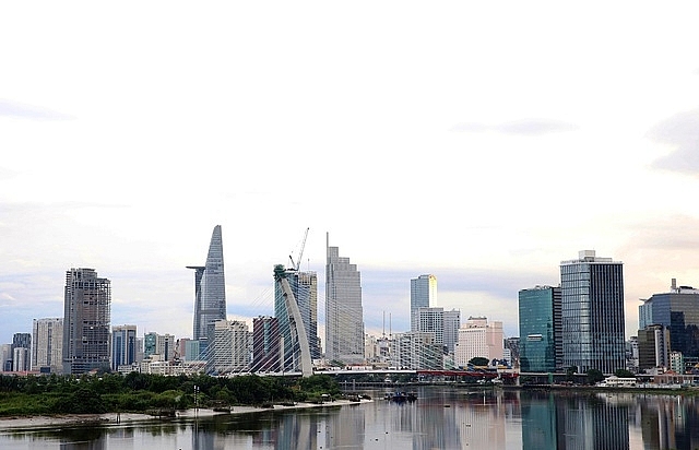 |
| The project to adjust the general planning of Ho Chi Minh City to 2040, with a vision to 2060, is required to clearly affirm the position and role of Ho Chi Minh City in the southern key economic region and the whole country as well as the representative focal point of Vietnam. in the region and the world - Photo: VGP/Ngoc Tan |
According to Chairman of Ho Chi Minh City People's Committee Phan Van Mai, it is necessary to clearly affirm the position and role of Ho Chi Minh City in the southern key economic region and the whole country as well as the representative focal point of Vietnam in the region and the world. It is not just traffic and logistics connections that need to be affirmed with soft power; Effectively promote the potential and strengths of geographical location and role as a regional economic center, create new spaces, new driving forces and propose policy mechanisms and methods for real planning. Feasibility.
In this planning project, the urban development framework is clearly shaped with the expansion of urban structure, the formation of cities within cities, and the balance between development and nature conservation. Accordingly, the City will develop according to a multi-center urban model, with 5 regions: Central urban area (including 15 districts), with an area of nearly 17,600 hectares, population of 5 - 6 million people; According to planning, this is an urban area for administration, foreign affairs, trade, services, culture, history, knowledge economy,...
The eastern urban area (Thu Duc City) has an area of 21,159 hectares, with a population of 2.3 - 3 million people; According to planning, this is a creative urban area, education - training, high technology, and financial center.
Northern urban area (Hoc Mon and Cu Chi districts), area of nearly 58,000 hectares, population of 3.3 - 5.2 million people; According to planning, this is a service urban area, ecological industry, etc. The northern urban center is located at the intersection of Ring Road 3 of Ho Chi Minh City and National Highway 22 to Ho Chi Minh City - Moc Bai Expressway.
The western urban area (Binh Chanh district), area of nearly 22,800 hectares, population from 2 - 2.8 million people; According to planning, this is an industrial urban area, commercial services, technology and health care services, biomedical and pharmaceutical center, etc. The urban center is located in the Tan Kien area.
Southern urban area (District 7, Nha Be district, Can Gio), area of more than 89,000 hectares, population of 3 - 4.2 million people; According to planning, this is a high-tech urban area, trade services, exhibitions, marine economic center, etc. Phu My Hung area (District 7) will be expanded to the south to become the center of the whole region. southern urban area.
Develop fast, multi-layer traffic
An issue people are very concerned about is how to plan traffic to solve the problem of congestion and flooding, especially at the city's gateway area. In this planning project, the Department of Planning - Architecture and related units and consulting units have researched and developed a traffic plan developed with a connection strategy to become a center. The city will arrange fast, multi-level traffic routes by developing overhead and underground routes. Connecting urban centers and regions with large-scale public transport routes and main road and waterway transport routes.
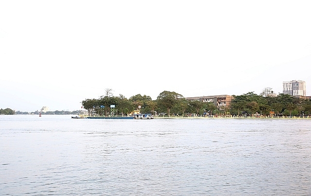 |
| Planning project orienting investment in multi-functional green infrastructure along the Saigon River, contributing to developing the service economy, restoring biodiversity, and increasing environmental quality in urban areas - Photo: VGP/Ngoc Ton |
Regarding the road, the southern driving axis will be extended parallel to National Highway 50 and connected to the coastal road in Tien Giang. Additional route connecting to Long Thanh airport from the city center via Phu My bridge. Add east connection to Dong Nai to Highway 20 to reduce load on Highway 1 and Ho Chi Minh City - Long Thanh - Dau Giay expressway. At the same time, connecting the coastal road from Go Cong (Tien Giang), through Soai Rap estuary to Can Gio and extending to Ben Luc - Long Thanh expressway (Dong Nai) through the road to Phuoc An port to support Can Gio international transshipment port in the future.
Regarding railways, connecting the Ho Chi Minh City - Can Tho railway with Ho Chi Minh City - Nha Trang through the elevated route along Nguyen Van Linh Street, Hanoi Highway, and Ring Road 2 of Ho Chi Minh City. In the future, the Hoa Hung - Binh Trieu - An Binh route will be converted into an urban railway.
Developing the Saigon River corridor
This planning project pays attention to the role of developing peripheral areas in the relationship of regional connection. Focus on areas with potential for synchronous infrastructure development and investment, especially multi-functional green infrastructure investment orientation along the Saigon River, contributing to the development of service economy and restoring biodiversity education, increase environmental quality in urban areas, enhance green areas along the Saigon River to serve the entertainment and resort needs of people in the city and the city area, effectively and sustainably exploit the value of the river corridor .
The city identifies the Saigon River as the center of Ho Chi Minh City planning for the new period and is an element of special interest in reviewing this general planning. The city has coordinated with the Paris Regional Planning Institute (IPR), the Vietnamese Science and Experts Association Global (AVSE Global) and multidisciplinary local expert groups to research and guide corridor development planning. Saigon river; Integrate appropriate, new, groundbreaking content... into the Ho Chi Minh City Planning Project and the City's General Planning Adjustment Project.
Accordingly, taking the space along the Saigon River as the facade for the urban area, from the traditional central area along the river, developing an urban strip on both sides of the river like an "open heart". Saigon River in the future will become an indispensable precious destination for all residents and tourists, a destination with a unique identity, associated with the landscape of the clear blue river, associated with the history of formation and development. of Ho Chi Minh City.
Organize a continuous strip of public parks along the river, to ensure accessibility and use of riverside amenities and services, creating conditions for the river to truly contribute to the sustainable development of Ho Chi Minh City and city area.
It can be affirmed that the Saigon River truly has enormous potential in the socio-economic development of a large region of the Southeast region. City leaders affirm and wish to exploit the economic potential and preserve and promote the historical cultural values, human ecology and economic service potential of this river.
It is expected that in the second quarter of 2024, the Department of Planning and Architecture of Ho Chi Minh City, together with related units, will complete the project to adjust the general planning of Ho Chi Minh City to 2040, with a vision to 2060, and submit it to the Ministry of Construction; and it is expected that in the third quarter of 2024, the project will be submitted to the Prime Minister for approval.
Along with development management policies and planning implementation, applying Resolution 98 of the National Assembly, this planning project is expected to contribute to Ho Chi Minh City's development on par with major urban areas in the world. world, is an attractive global destination.
News other
- Suburban house for 3-generation family with rice drying yard on the upper floor(04/10/24)
- Catch the sun in the townhouse(04/10/24)
- 3-storey house designed for three-generation families(23/05/24)
- Fall in love with the open, dark-toned villa design in Binh Duong(22/05/24)
- Impressed with the 5-storey townhouse design that is always airy(22/05/24)
- Furnished 3-bedroom apartment is only 330 million VND, surprisingly beautiful inside(16/05/24)
- The house designed two skylights to help circulate air(16/05/24)


